About All Tours Offroad ToursFrom Palm Springs ToursSelf-Guided Audio ToursHiking ToursRock Climbing Tours Directions Hours & Fees
Find Tours 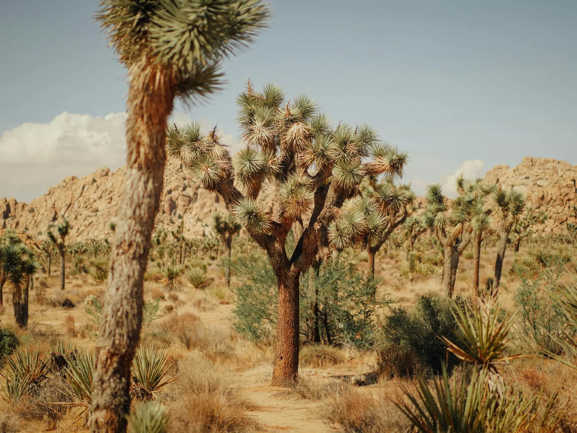
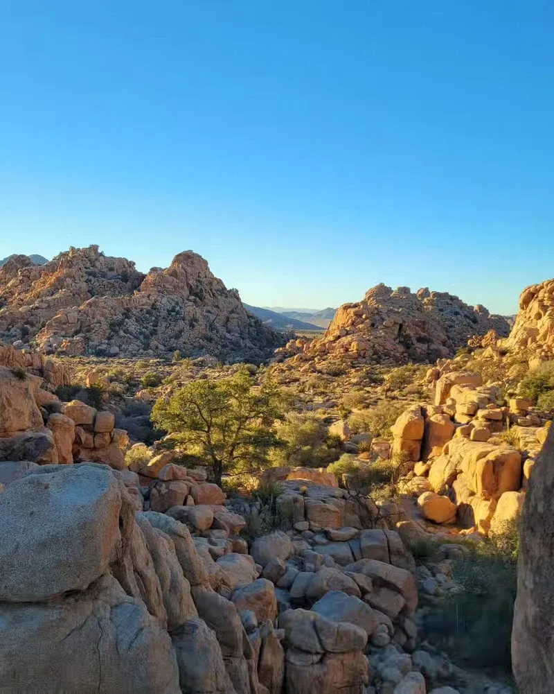
Joshua Tree National Park protects nearly 800,000 acres of desert landscape east of San Bernardino, California. The Mojave and Colorado ecosystems collide here, creating an environment defined by twisted yucca trees and massive monzogranite boulder piles.
Joshua Tree National Park covers 792,623 acres in southeastern California, sitting directly between the Mojave and Colorado deserts. Two distinct ecosystems merge across this boundary. The higher, cooler Mojave supports the park's namesake Yucca brevifolia, while the lower Colorado Desert features sparse creosote bush and dense patches of jumping cholla cactus. Temperatures dictate every aspect of life here. Summer highs frequently exceed 100°F (38°C) in July and August, rendering the interior dangerous for daytime hiking.
Visitors drive through valleys dominated by massive monzogranite boulder piles and twisted, spiky trees. The wind constantly funnels through narrow rock corridors, carrying sand that stings exposed skin during spring storms. No water exists in the park's interior. You must bring all hydration from the outside, carrying at least one gallon per person daily. Cell service drops completely a mile past the entrance stations.
Eighty-five percent of the park's 500 campsites require reservations up to six months in advance via recreation.gov. Weekends from October to May bring heavy traffic, filling parking lots at Skull Rock and Hidden Valley by 9:00 am. The West Entrance line often backs up for miles along Highway 62. Buying a digital pass beforehand saves 30 minutes at the gate.
Human habitation in the basin dates back 10,000 years. Hunter-gatherers of the Pinto Culture occupied the area between 8000 and 4000 BCE, leaving behind stone tools and projectile points along the now-dry Pinto Basin. Climate shifts eventually forced these early populations to adapt as the lush environment dried into a harsh desert. Native American groups, including the Serrano, Cahuilla, and Chemehuevi, later established seasonal camps near reliable water sources like the Oasis of Mara. They harvested pinyon nuts, mesquite beans, and utilized the tough leaves of the Joshua tree for weaving baskets and sandals.
Pedro Fages led a group of Spanish explorers through the region in 1772, marking the first recorded European sighting of the distinctive yucca trees. Mormon pioneers crossing the desert in the 1850s supposedly named the plant after the biblical figure Joshua, seeing the upward-reaching branches as arms raised in prayer. By the late 1800s, cattle ranchers and gold miners moved in. They blasted tunnels into the rock and built structures like the Wall Street Mill to process gold ore. Rustlers used the enclosed, boulder-ringed pastures of Hidden Valley to hide stolen cattle from the law.
Minerva Hoyt, a Pasadena resident, noticed the rapid degradation of the desert in the 1920s. Poachers were uprooting cacti and Joshua trees to landscape Los Angeles gardens. She launched a relentless campaign to protect the area, resulting in President Franklin D. Roosevelt establishing 825,000 acres as Joshua Tree National Monument in 1936. Decades later, the California Desert Protection Act of 1994 elevated the monument to a national park. President Bill Clinton signed the legislation on October 31, 1994. Today, the park protects 88 historic structures and over 700 archeological sites.
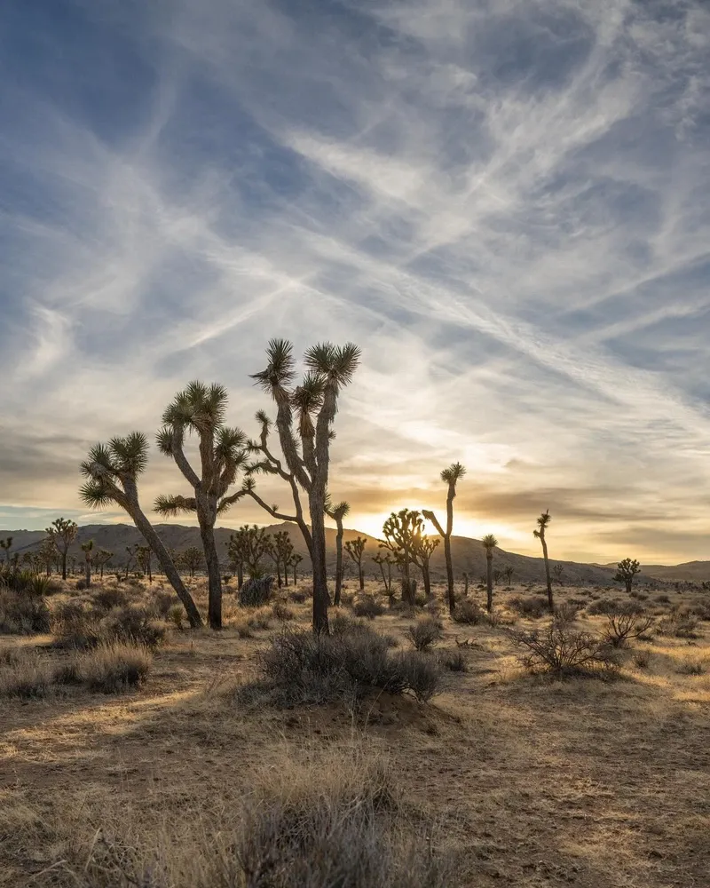
Monzogranite boulder formations define the park's skyline. These massive, rounded rocks began forming over 100 million years ago when molten magma cooled deep underground. Groundwater seeped into rectangular fractures, rounding the sharp edges before tectonic uplift and erosion exposed the piles on the surface. Climbers flock to these formations, gripping the coarse, sandpaper-like texture of the granite to scale routes up to 150 feet high.
The Pinto Gneiss represents the oldest rock in the park, dating back 1.7 billion years. This dark, metamorphic rock contrasts sharply with the lighter monzogranite and dominates the mountains in the eastern Colorado Desert section. Fault lines crisscross the landscape. The San Andreas Fault runs just south of the park boundaries, visible from the 5,000-foot elevation of Keys View Lookout.
Vegetation changes abruptly with elevation. The Mojave section sits above 3,000 feet, providing the cooler climate required by the Yucca brevifolia. These trees grow only one to three inches per year, with some specimens reaching 40 feet tall and living for over 150 years. Down in the Pinto Basin, the elevation drops to 536 feet. Here, the Cholla Cactus Garden concentrates thousands of teddybear cholla into a dense 10-acre patch. The segments detach easily. Walking off the designated path often results in barbed spines piercing through shoes and clothing. Tweezers are a mandatory first-aid item for removing embedded needles.
The desert landscape holds deep spiritual importance for the Native American tribes who have lived here for millennia. The Cahuilla, Chemehuevi, and Serrano people maintain strong cultural ties to the land, viewing the mountains, springs, and plants as living entities. The Oasis of Mara, located near the Twentynine Palms entrance, served as a crucial gathering place where tribes planted palm trees to signify the birth of male children.
Artists and musicians began gravitating to the region in the late 20th century, drawn by the isolation and stark visuals. The 1987 release of U2's album The Joshua Tree cemented the plant's silhouette in global pop culture, though the actual tree photographed for the album cover stood hundreds of miles away near Death Valley. Local installations like the Noah Purifoy Outdoor Desert Art Museum continue this creative legacy, featuring large-scale assemblage sculptures built from discarded materials.
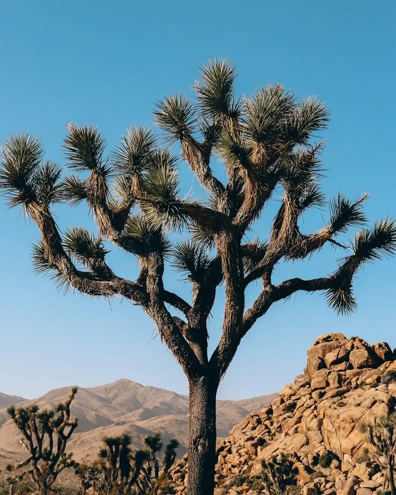
The park's designation as an International Dark Sky Park protects a different kind of cultural resource: the night sky. Strict lighting regulations in the surrounding communities ensure the Milky Way remains visible. Night photography workshops operate only in designated zones like Echo T and Twin Tanks. They are strictly prohibited from illuminating rock formations with artificial light to avoid disturbing nocturnal wildlife.
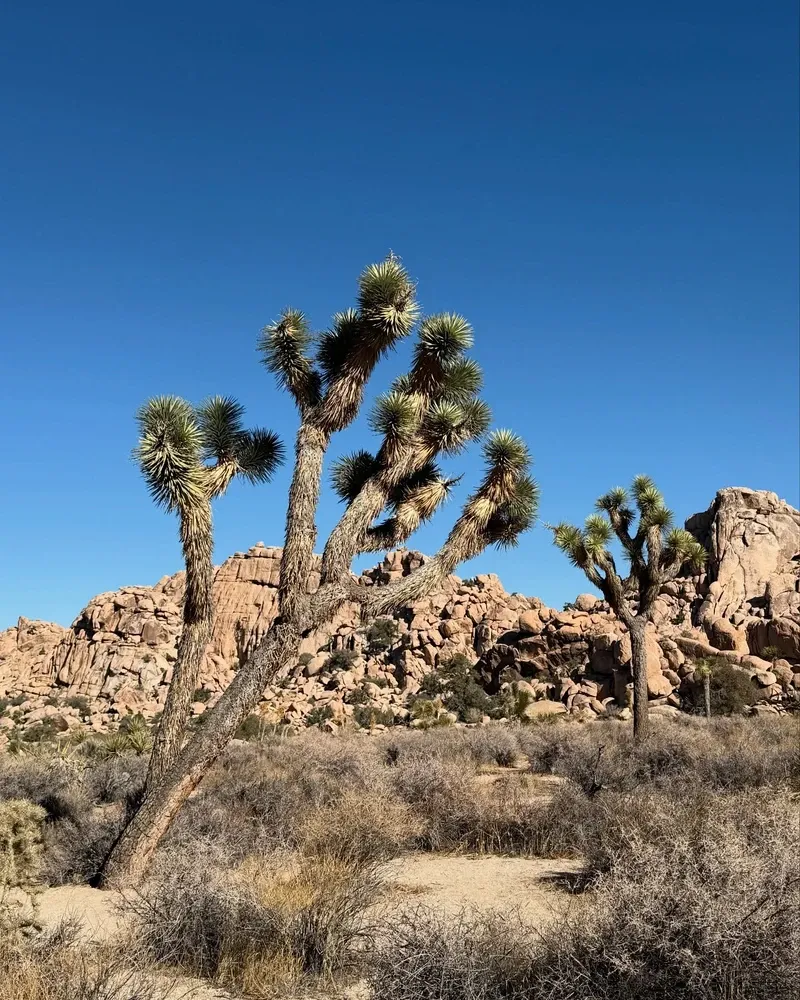
The park contains two distinct desert ecosystems: the higher Mojave and the lower Colorado.
Joshua trees are not actually trees, but a species of yucca plant native to the Mojave Desert.
Over 250 bird species live in or migrate through the park's boundaries.
The park is an official International Dark Sky Park, offering some of the clearest stargazing in Southern California.
The Pinto Gneiss rocks found in the eastern section of the park are 1.7 billion years old.
Flying drones is strictly prohibited everywhere inside the park to protect native wildlife.
There is absolutely no running water or plumbing available in the park's interior.
A standard 7-day vehicle pass costs $30.00. Individual entry on foot or bicycle costs $15.00, and children under 16 enter for free.
No water exists in the interior of the park. Visitors must bring all their own supplies, carrying at least one gallon per person daily.
Pets are strictly prohibited on all park trails and paths. They must remain on a leash at all times and cannot go more than 100 feet from any paved road.
The park remains open 24 hours a day, 365 days a year. Visitors can drive in and out at any time, even when entrance stations are unstaffed at night.
You can book a campsite up to six months in advance via recreation.gov. Eighty-five percent of the park's 500 campsites require reservations and fill up rapidly on weekends.
Flying drones is strictly prohibited throughout the park. The ban protects the natural environment and prevents disturbances to native wildlife.
Arrive at sunrise or one hour before sunset. The low golden light illuminates the translucent spines, creating a glowing effect across the 10-acre landscape.
Ranger-led tours run from October to May and require advance reservations. Tickets cost $10.00 and must be purchased in person at the Twentynine Palms visitor center.
Cell reception is generally unavailable throughout the vast majority of the park's interior. Download maps and offline navigation guides before passing the entrance stations.
Stay with your vehicle until help arrives. Do not wander into the desert. Emergency phones are located at Intersection Rock, Cottonwood Visitor Center, and Indian Cove Ranger Station.
Browse verified tours with free cancellation and instant confirmation.
Find Tours